
Khao Yai Travel Guide · Chapter 4 of 8
Khao Yai's Waterfalls and Viewpoints
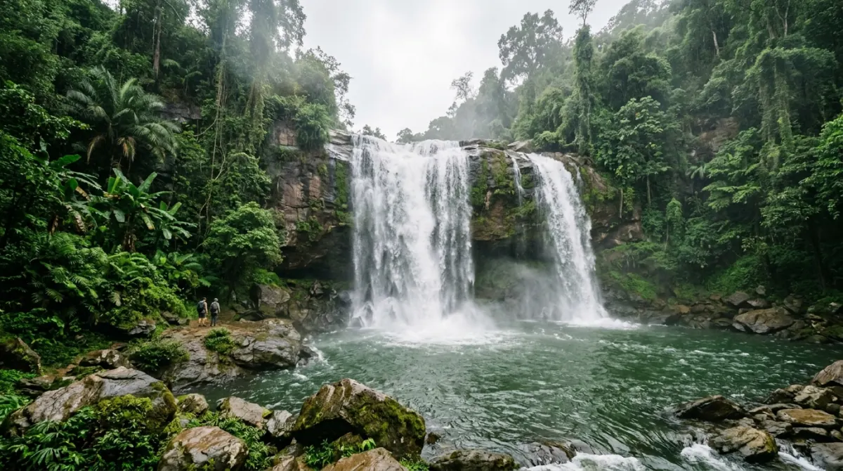
Haew Suwat, the fall from The Beach, is a 100-metre walk from the car park. Haew Narok, the park's tallest, is 2 km return down a steep 50-metre staircase, 36 km from the north gate. June–October it is the park's best sight; February–May it can be a dry cliff. Swimming is banned at both, year round.
At a glance
| Site | Scale | From the Visitor Centre | On foot | Status |
|---|---|---|---|---|
| Haew Suwat | About 25 m | 10 km | ~100 m to the viewpoint, then stairs to the pool | Open; swimming forbidden |
| Haew Narok | Over 150 m, three tiers | 22 km, via Highway 3077 | ~1 km path, then a staircase down about 50 vertical metres | Swimming forbidden; closes in some rainy seasons |
| Pha Kluai Mai | About 10 m | 7 km | Short walk from the campground | Open; swimming forbidden |
| Kong Kaew | Small cascades | 100 m | A few minutes on the flat | Open; swimming forbidden |
| Pha Diao Dai viewpoint | About 900 m elevation | Km 9, Khao Khieo spur | 450 m boardwalk | Closed 1 June – 30 September in 2025 and 2026 |
| Khao Khieo (Pha Trom Jai) | 1,290 m elevation | Km 10, further along the same spur | Short walk | Open |
| Km 30 viewpoint | — | Thanarat Road, km 30 marker | Roadside | Open |
Park gates open 06:00–18:00; tourist information runs 08:30–16:30 on 086-092-6529, the number to call about closures. Foreign adults pay 400 THB at the gate — entry fees and park rules are set out in the previous chapter. Distances and in-park drive times are from the orientation chapter's distance table; the times there are estimates from the posted 60 km/h limit, not published figures.
Haew Suwat: the waterfall from The Beach
Haew Suwat is the most visited waterfall in Khao Yai and the least demanding to reach: 10 km from the Visitor Centre, then about 100 metres from the car park to a viewpoint over the drop, with concrete steps down to the pool. Roughly 600 metres return, under an hour. The park gives the height as about 25 metres; several guides say nearer 20.
The film connection is narrower than most people expect: the cliff-jump scene in The Beach (2000) was shot here, but the beach itself is Maya Bay on Ko Phi Phi Leh, several hundred kilometres away.
That scene is also why the rules matter. Swimming is forbidden here, and so is jumping — all year, not as a wet-season restriction, and the same at Haew Narok, Pha Kluai Mai and Kong Kaew. Plenty of older blog posts describe swimming here. They are out of date.
In the wet season the water crosses the full ledge as one sheet; in the dry season it thins to a single strand. Worth 45 minutes either way, mostly because it costs so little to get there.
Haew Narok: the tallest, and whether the stairs are worth it
Haew Narok is the park's tallest at over 150 metres in three tiers — but from the viewing platform you see only the top tier, roughly 60 metres of it. Some sources claim 180 or 200 metres; the park says "over 150".
It is a commitment. Haew Narok is 22 km from the Visitor Centre on Highway 3077, the southern road — about 36 km from the northern Pak Chong gate, on a different road from Haew Suwat. From the car park it is a sealed kilometre of path and a footbridge, then a steep, narrow staircase dropping about 50 vertical metres. Two kilometres return, and the climb back out is the part you feel.
The honest verdict. From June to October this is the best single sight in the park and the drive is justified. From roughly February to May it is not. Haew Narok dries up completely in some years: in April 2024 park officials confirmed its feeder streams had dried, leaving only pools in the rock basins below, and in 2016 the park reported the stream dry from late February, the third year running. Driving 36 km each way to photograph a dry cliff is the easiest mistake to make here.
Why the site is managed the way it is
Haew Narok sits at an elephant crossing with a long record. On 5 October 2019 a herd went over the falls; six bodies were found first and drone footage later located five more, for a confirmed toll of eleven. Officials concluded that a three-year-old calf fell and adults died trying to reach it. Two elephants were found alive on a ledge and rescued, one believed to be the calf's mother. Eight died at the same place on 2 August 1992, and two more in July 2022.
Concrete barriers were built upstream along both banks after 1992; they had degraded by 2019 and elephants broke through. That is why the fencing and the abrupt closures exist.
Pha Kluai Mai and the trail to Haew Suwat
Pha Kluai Mai is a 10-metre waterfall 7 km from the Visitor Centre, and on its own it does not compete with the other two. The trail is the point. Official Trail 2 runs 3 km from Pha Kluai Mai campground to Haew Suwat in about two hours, graded easy to moderate, no ranger guide required, listed as open year round. It follows the Lam Takhong stream through bamboo and evergreen forest, and is the best forest walk here that needs nothing arranged in advance.
The catch is logistics: it runs one way between car parks 3 km apart, so someone moves the vehicle or you walk it twice. The name refers to the wild orchids on the cliff face, which flower in the dry season — a real consolation in the months when the water is thin.
Kong Kaew is the fourth waterfall and the smallest: a set of low cascades 100 metres from the Visitor Centre, flat the whole way. It is a fifteen- or twenty-minute stop, not an hour, and it earns that only because you are already parked at the Visitor Centre. Do not build a schedule around it, and do not drive to it.
Pha Diao Dai and the escarpment viewpoints
Pha Diao Dai is the best-known viewpoint in the park, at about 900 metres, reached by a 450-metre raised boardwalk through hill evergreen forest and a high-altitude swamp. The clifftop is a flat stone shelf with no railings. The park names sunrise as the best time.
For a day visitor that is close to impossible. The gates open at 06:00 and sunrise here falls somewhere between roughly 05:50 and 06:45 depending on the month, while Pha Diao Dai is a long drive inside the park from either gate, at a 60 km/h limit with speed bumps. Unless you are sleeping in park accommodation, aim for the first two hours after opening, while mist still sits in the valleys.
Two others stay open through that closure, and neither is a straight replacement. Km 30, on Thanarat Road, is a roadside pull-in rather than a destination: worth ten minutes early for mist in the valley and worth timing properly at twilight for the bat flight, which is the only reason to make a special trip. Khao Khieo (Pha Trom Jai) sits about a kilometre further along the same spur road at 1,290 metres and is described by the park as the highest viewpoint in central Thailand. In the cool season, with migrant birds about and the air clear, the spur drive is worth making on its own. Between June and September, with Pha Diao Dai shut, it is the consolation prize and an adequate one — but note that "highest viewpoint in central Thailand" is the park's own claim about altitude, not about the view, and it is a different sort of place from Pha Diao Dai's open stone shelf.
Month by month: when the water is actually running
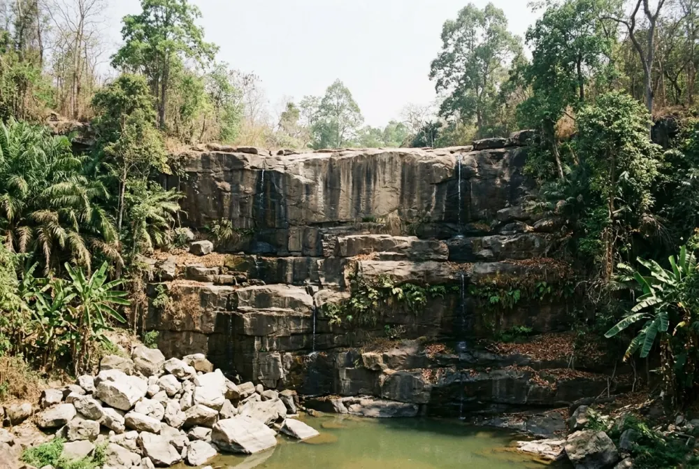
Khao Yai's waterfalls are rain-fed and unregulated, and the gap between September and March is the gap between a torrent and a stain on the rock.
| Month | Water level | What that means |
|---|---|---|
| January | Falling | Cool, clear, comfortable. Haew Suwat down to a single strand. |
| February | Low | Haew Narok has run dry from late February in documented years. |
| March | Lowest | Haew Suwat can be a trickle. Do not plan a trip around waterfalls. |
| April | Still low | Hottest month. Haew Narok dried out entirely in April 2024. |
| May | Recovering | First real flow, usually late in the month. Leeches return. |
| June | Running well | Pha Diao Dai closes on the 1st. |
| July | Strong | The 8 km guided trail to Haew Suwat closes for two months. |
| August | Strong | Peak flash-flood risk; the month Haew Narok has often shut. |
| September | Peak | Wettest month of the year, and the highest chance of closures. |
| October | Peak, easing | Closures lift, Pha Diao Dai reopens. The best month overall. |
| November | Strong residual | Dry weather over full falls. The best all-round compromise. |
| December | Thinning | Still worth seeing. Coldest nights, sometimes under 10°C. |
The water-level column is a judgement from long-term rainfall averages and reported conditions, not a park measurement. One storm can change it in a day, and flow lags rainfall by a month or two — which is why December and January still run despite being the driest months on paper. Rainfall in millimetres, wet days and temperatures month by month are in the practical chapter.
The best months for water are also the months with the most closures and the worst walking conditions. Late October and early November is the sweet spot: full falls, closures lifted, drying paths, and the leeches thinning out as the wet season ends.
Safety: slippery rock, closed platforms and the swimming ban
Wet rock does most of the damage. The stone at the top of Haew Suwat and on the Haew Narok stairs is polished and slick, and sandals are the wrong footwear. Then there is the ground itself: the April 2025 landslide followed days of heavy rain saturating the slope, and platforms close at short notice with no warning. And the water — these are flash-flood catchments, and September is the wettest month of the year.
Plan the end of the day backwards from 18:00. The waterfalls empty out well before the gate closes, and on weekdays the in-park restaurants shut at 18:00 too, the same hour as the gate, so they are not a late fallback (in-park food and its hours). An afternoon starting at 15:00 is tighter than it looks. Mobile signal is patchy — check closures before you set off, not from the car park.
Frequently asked questions
Which waterfall in Khao Yai was in The Beach?
Haew Suwat. The cliff-jump scene in the 2000 film was shot there, and the pool you see from the viewpoint is the one in the scene. The beach in the film is Maya Bay on Ko Phi Phi Leh, a different part of Thailand entirely.
Can you swim at Haew Suwat waterfall?
No. The park lists swimming as forbidden at Haew Suwat, Haew Narok, Pha Kluai Mai and Kong Kaew, and cliff-jumping is prohibited. The ban applies all year, not only in the rainy season. Two wild Siamese crocodiles live in the Lam Takhong stream and warning signs are posted.
Is Haew Narok waterfall worth the walk?
In the wet season, yes — it is the tallest waterfall in the park and the best thing in it. Between roughly February and May, no: it has dried up entirely in several documented years, and it sits 22 km from the Visitor Centre on a different road from Haew Suwat. Ask about water levels on 086-092-6529 first.
When do Khao Yai's waterfalls have the most water?
September and October, at the end of the rainy season. September is the wettest month of the year — see the month-by-month rainfall table — but it also carries the highest chance of flash-flood closures. Late October and early November is the better target: full falls, closures lifted, drying paths and the leeches thinning out.
Is Pha Diao Dai viewpoint open?
Not between 1 June and 30 September — the viewpoint and its nature trail close for habitat restoration and reopen in October. That closure ran in 2025 and again in 2026, but the park has not published it as a standing annual rule, so treat it as annual and confirm on 086-092-6529 before you build a morning around it. Km 30 and Khao Khieo (Pha Trom Jai, 1,290 m) stay open year round.
How long does it take to see both waterfalls in one day?
Allow most of a day. Haew Suwat and Haew Narok sit on different roads roughly 30 km apart — about 30 minutes at the park's 60 km/h limit on paper, and 40 to 50 minutes in practice each way with the speed bumps, the junctions and whatever is ahead of you. From the Visitor Centre it is 20–25 minutes out to Haew Suwat and about 40 to Haew Narok; the distance table in the orientation chapter has the legs, and those times are estimates from the posted limit rather than published figures. Add an hour at each fall and the gate queue: six or seven hours. Nothing runs inside the park, so this needs your own vehicle or a driver — how people get here and get around.
Related
- Previous: Inside Khao Yai National Park: Entry, Rules and What You'll Actually See
- Next: Khao Yai Wine Country: PB Valley, GranMonte and the New Latitude
- Also useful: Getting to Khao Yai for how to reach the park and cover ground inside it, and a full-day Khao Yai tour if you would rather not drive it yourself.
Last updated: 2026-08-29. Route timing and road notes come from Smile Taxi Service drivers who run Khao Yai tours weekly.